The initial survey takes place during one week in May, beginning Mother's Day weekend. Our first survey day was reported in a previous blog entry. http://lindafink.blogspot.com/2014/05/a-whale-of-day.html A follow-up survey is conducted at each site within a week, hopefully, of the last visit.Tuesday and Wednesday of this week we did our follow-up surveys. Since the timing worked to combine with our Beached (dead) Bird Survey, we canoed across the Salmon river on Tuesday, hiked the beach looking for dead birds (found none), canoed back across and drove to Road's End.
On this trip Johnny hiked up The Thumb to our usual observation post, while I hiked to the top of the cliff, then down around the cove that is north of The Thumb to where I can look down on the North Nest Rock birds and actually see their nest. Photos of this insanely difficult trek follow.
Of course, the first rule of a long, steep hike is to stop and take photos of flowers (and breathe).


That bump on the left in the photo below is the top of The Thumb, where we usually sit to watch BLOY. Johnny was on his way up there when I reached the top of the cliff far above him.

Thanks to the zooming wonders of my Panasonic Lumix camera, there he is, on his way up.

And even closer...

Far, far below me was the cove that lies north of The Thumb. My goal was its north rim, a long way down through a trail-less jungle. But it would not have taken me an hour if I had not managed to get lost and had to back-track. Next time I'll be faster.

Johnny spotted me when I finally appeared across the cove from him. I'm a dot in the lower left of the photo below.

And zoomed closer... I'm standing in the middle of the salal field looking down on the North nest rock.

And here is the rock. Try picking out black birds on this rock!

It took a while, but I finally spotted red bills. The setting BLOY is in the bottom of the photo just left of center. The guarding BLOY is at the top just left of center.
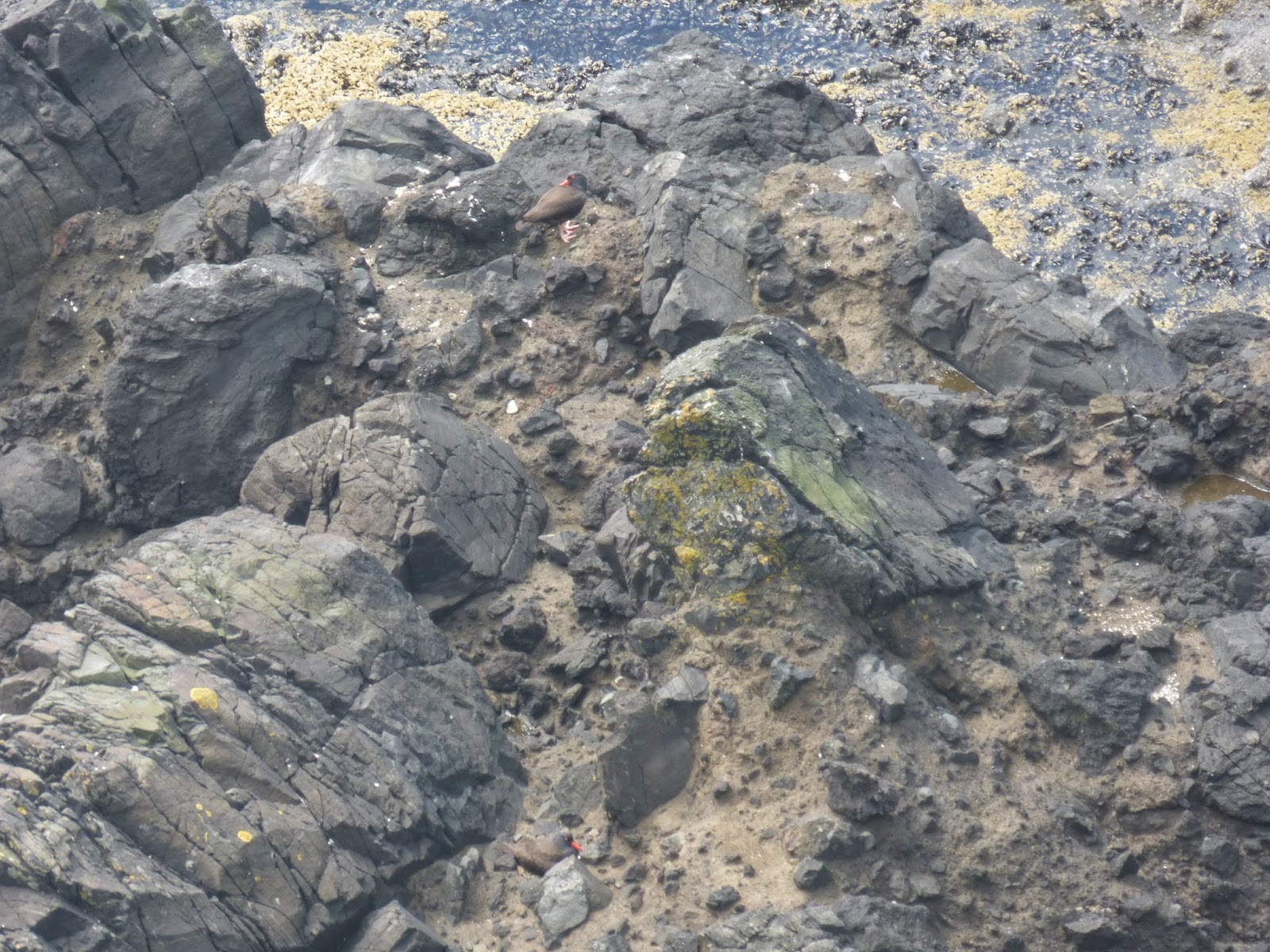
Here is the one on the nest, closer.

And the BLOY on guard duty.

Johnny could see neither bird from his position atop The Thumb. That knob on the left of the photo is The Thumb.

The dot in the middle of the two trees is Johnny looking through his scope at the nest rocks below.

Here he is...

Mission accomplished, I headed back. But first I stopped to take a photo of the incredible view looking north. Camp Westwind's Crescent Cove was just below me. The long beach beyond the rocky outcropping in the middle of the photo is where we had just done our beached bird survey. And beyond that: Cascade Head. The view alone was worth the hike. (In retrospect.)


We ended our day on the coast with dinner at the Nepali restaurant in Lincoln City, joined by friend and fellow BLOY enthusiast, Caroline.
The next day, we did our follow-up surveys of Cape Kiwanda and Cape Lookout: two more long, strenuous hikes. Crazy, yes?


No comments:
Post a Comment